GREENFIELD — Within the next week or so, images of people who lined some of Hancock County’s main roads during two evenings this past summer are expected to start showing up on Google Street View, the county tourism director says.
The Google Street View photos were anticipated to appear online in late August or early September, but an update to Google’s interface postponed Hancock County Tourism’s consultant, Truly 360, from uploading the images, said Brigette Cook Jones, executive director of Hancock County Tourism.
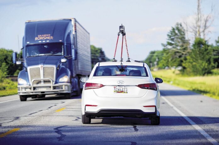
In late July, Truly 360, a San Diego-based marketing company that contracts with Google, filmed nearly 200 miles of Hancock County roads, highlighting businesses, organizations and events in each town.
By the time Truly 360 finished processing the photos, Google announced it was going to change the way companies upload Street View photos, Jones said, which meant no new content could get uploaded until Google finalized the new interface. Last week, David Meyers, the Truly 360 employee that filmed the Street View photos, told Jones to expect to start seeing new images as early as this week.
Two evenings in late July, a few hundred people stood along some of the main roads in New Palestine, Cumberland, Mt. Comfort, McCordsville, Fortville and Greenfield. Some smiled, cheered and held signs marketing businesses and the towns as the vehicle, which had a camera mounted to the roof, drove by.
Jones has previously told the Daily Reporter that the Street View shoot improves the county’s online presence. Hancock County Tourism pays Truly360 close to $2,000 a month to pull event and business information year-round from the tourism website, using it to promote Hancock County on Google. The Street View photos will also include the tourism logo and website URL, Jones said.
Truly360 also took 360-degree videos inside the county’s top four hotels; conducted one-on-one training with hotel managers; and recorded drone aerial tours in Fortville and Greenfield, Jones said.
The agency recently contracted with a photographer from Indianapolis to take drone footage and other videos and photos of the Riley Festival parade and crowds to upload onto Google, Jones said. That was to make up for a sudden cancellation in Greenfield on the first day of the Street View shoot in July.
Jones said Hancock County Tourism owns the Street View and drone footage, meaning the department can use the videos and photos in any sort of advertisement, such as television commercials.
Street View, featured as part of Google maps, provides a street-level, 360-degree view of streets, roads and highways. It was launched in 2007 and has mapped more than 10 million miles of roads in more than 80 countries.


